Kenya: Architecture as Territory
An Ecological Analysis of a future Library in Kakamega, Kenya
David Maria d’Olimpio
Urban Theory, In collaboration with Dameron Architects
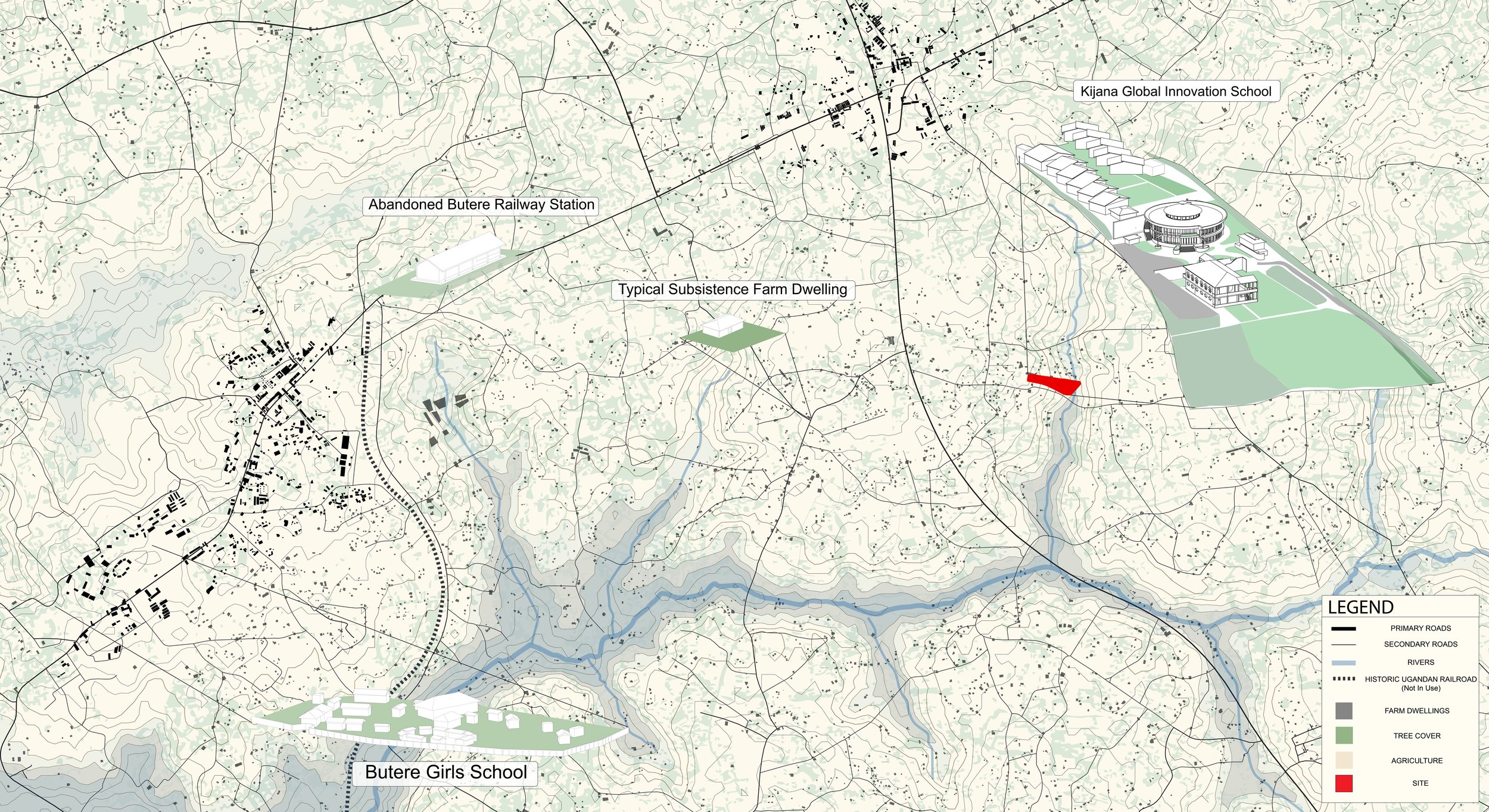
As an Architectural Designer at Dameron Architecture, I undertook extensive research on behalf of the firm to contextualize and inform the design of the Kijana Global Innovation School near Butere, Kenya. Through GIS software, historical research, and projected climate conditions, I developed a series of mappings that reveal the local and regional conditions that make the Kakamega region what it is today.
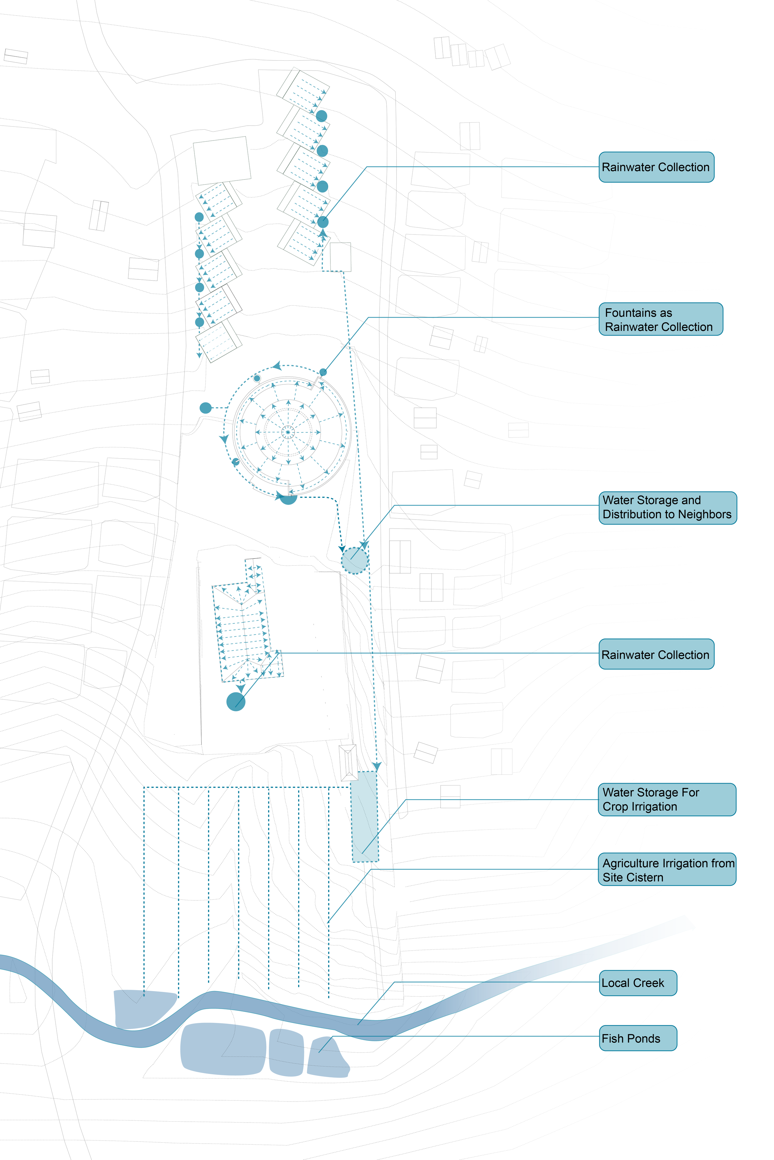
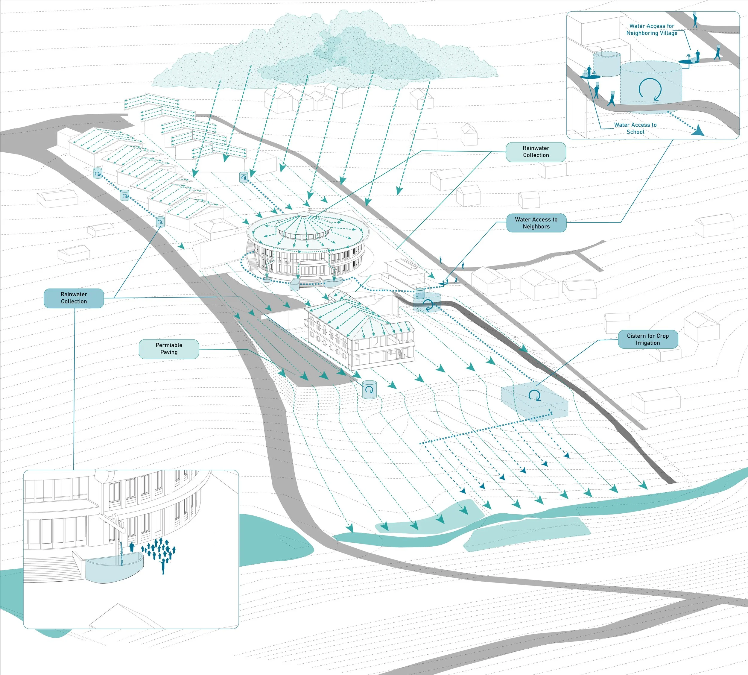
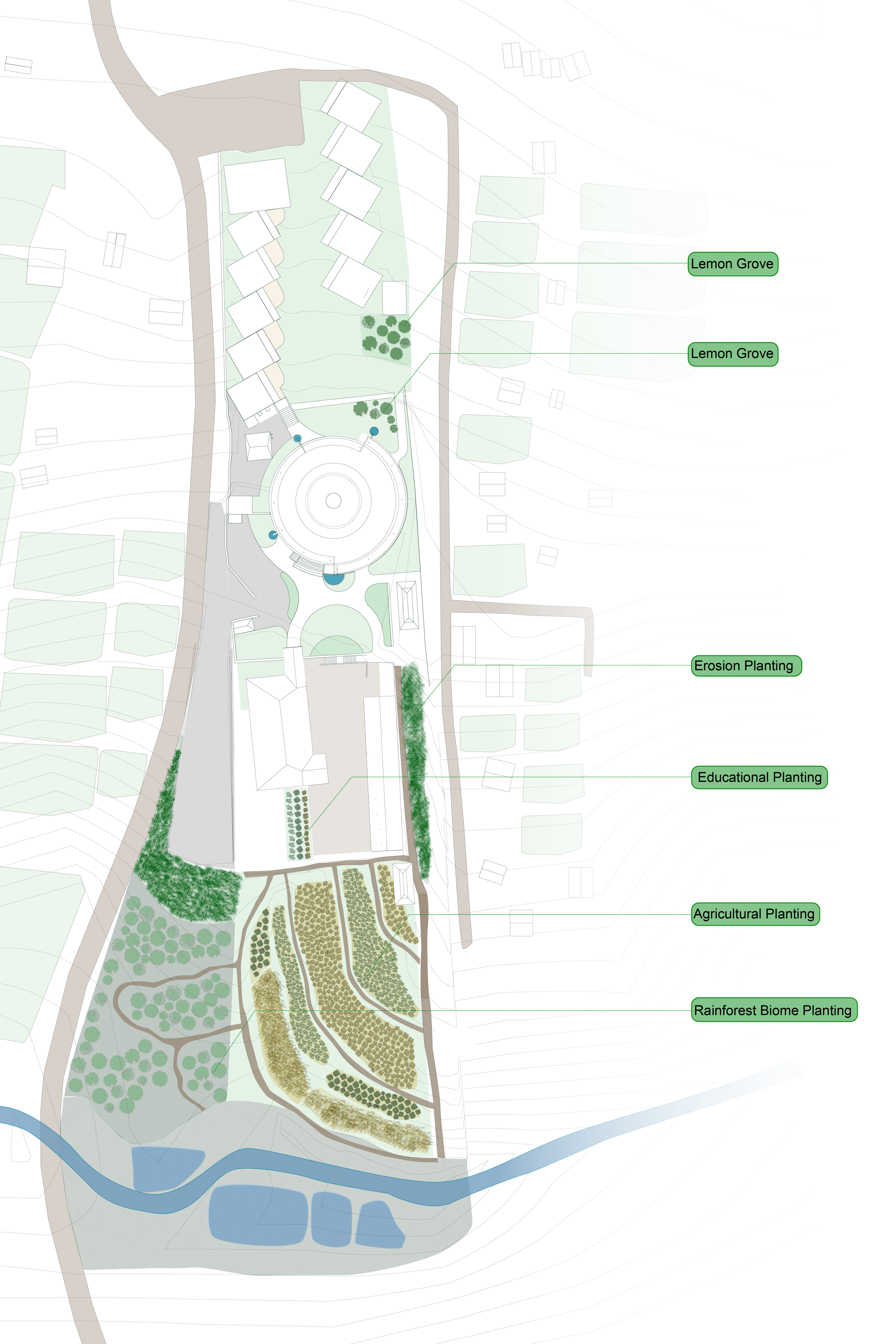
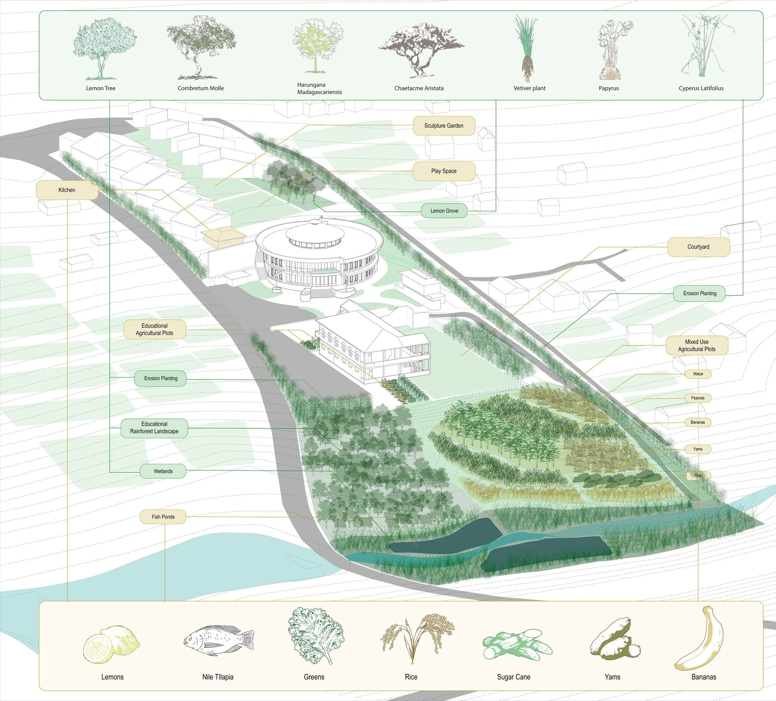
These mappings inform aspects of the building’s design and connection to local landscape. The library functions not only as an essential component of the campus, but also as a thermal regulator, water collection vessel, and educational tool for water management and agriculture: blending the boundary between architecture, landscape, and territory. Currently in construction, the project seeks to collect and store enough rainwater to irrigate all of the campus’ agricultural production while providing the excess to neighboring subsistence farms.
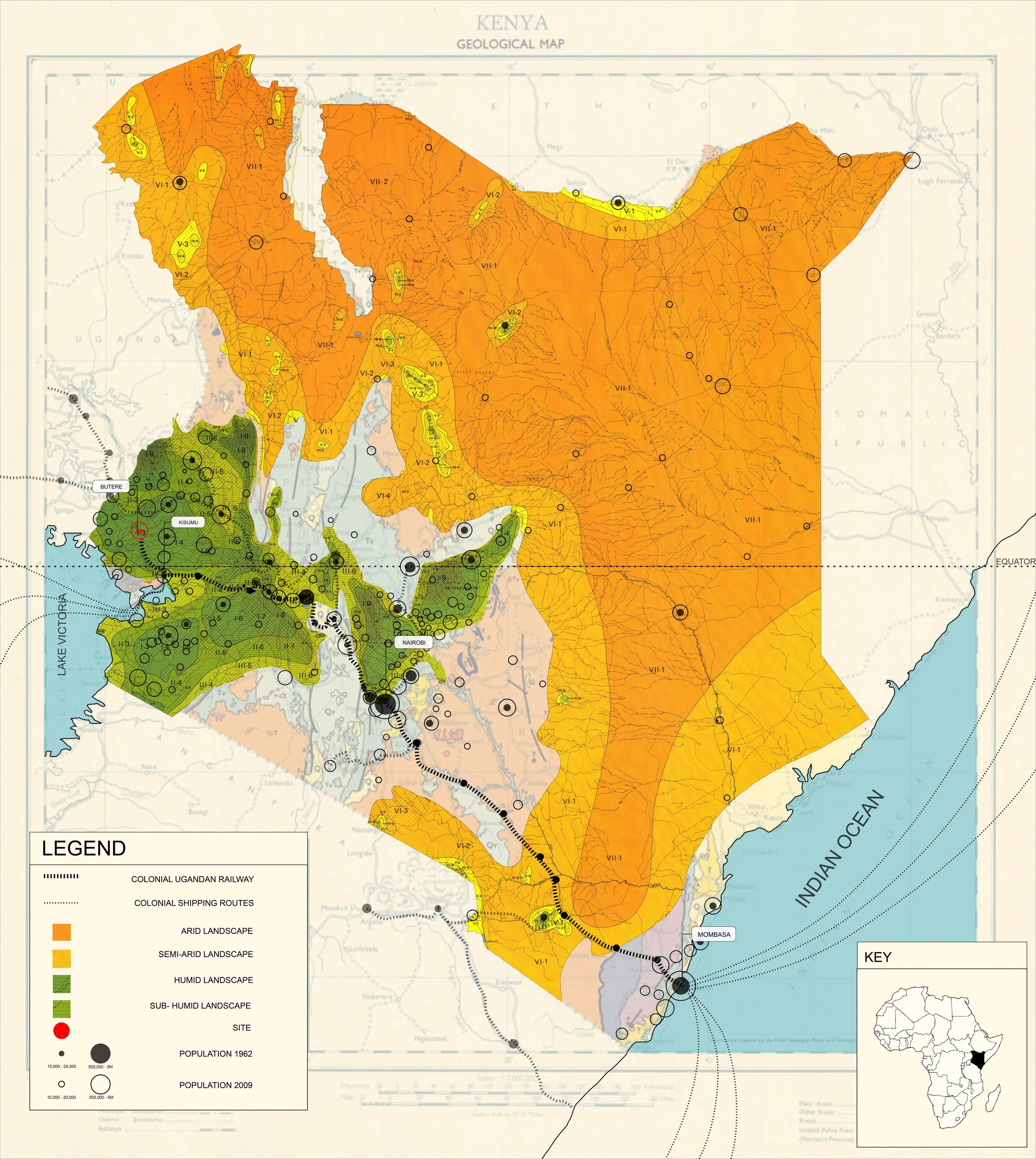
Kenya
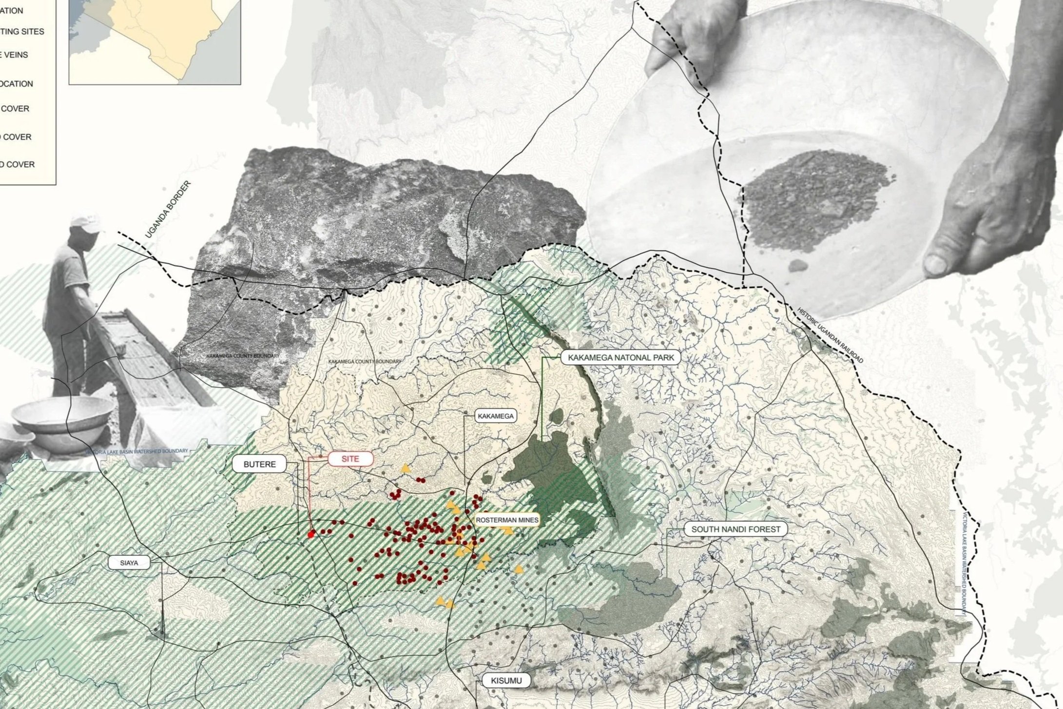
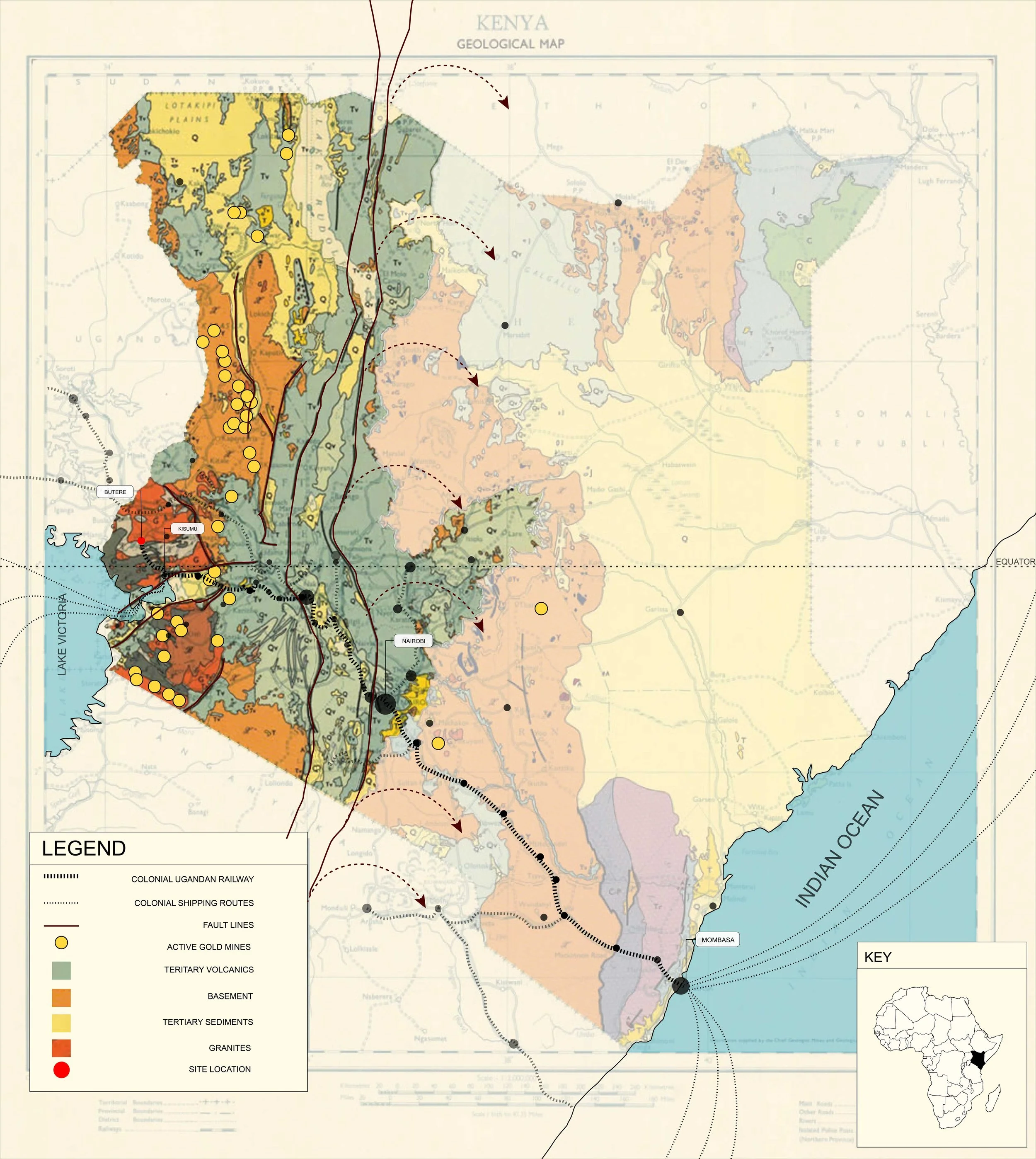
The iconic Great Rift Valley is a tear across Kenya creating a new tectonic plate - slowly cracking granite rocks open to fill with veins of molten gold. These deposits lay buried until Kenya’s colonization by the British, who shipped it along a new railroad that spanned 600 miles to unite the shores of Lake Victoria and the Indian Ocean, and another 6000 miles to the British Isles. Much of it remains there today.
Along with gold, colonial powers found ideal conditions for cash crops: sugar cane, corn, and cotton. Once indigenous populations were coerced into mass production through forced taxation and subjugation, the railroad diversified its uses - exporting resources and importing tourists and further exploiters.
Post colonization, ripples from the impact of this production can be seen through an exponential rise in population along the railroad routes and within the lake’s watershed.
The Lake Victoria Watershed
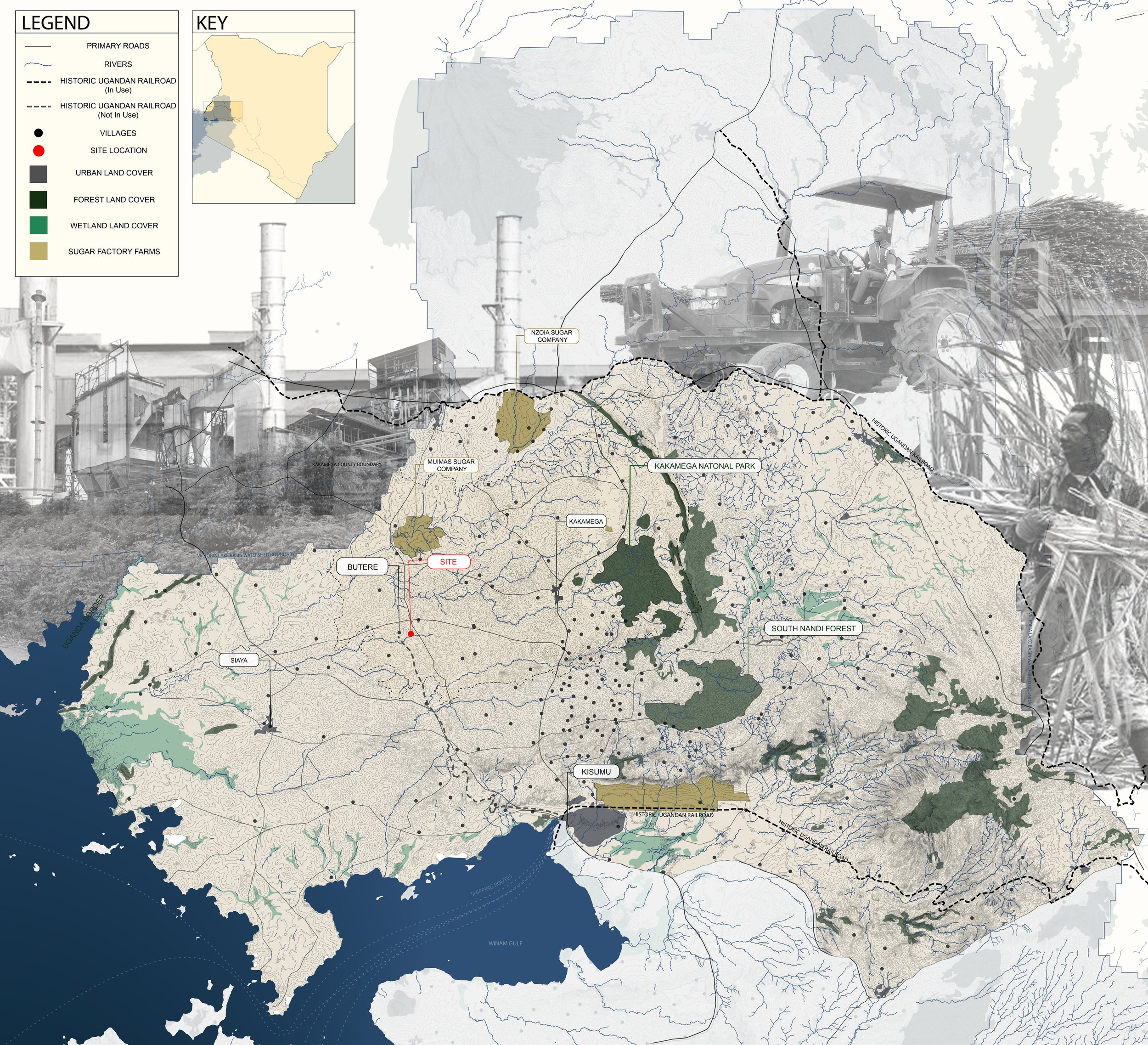
A majority of agricultural production from villages within the Lake Victoria Watershed was focused on sugar cane - with seed, equipment, transport, and processing monopolized by large sugar corporations in the region. Price gauging, high transport fees, and over-harvesting to meet quotas has culminated in sugar cane production falling so rapidly in the last few years that processing plants have shut down or reduced operating hours by half in mid 2025.
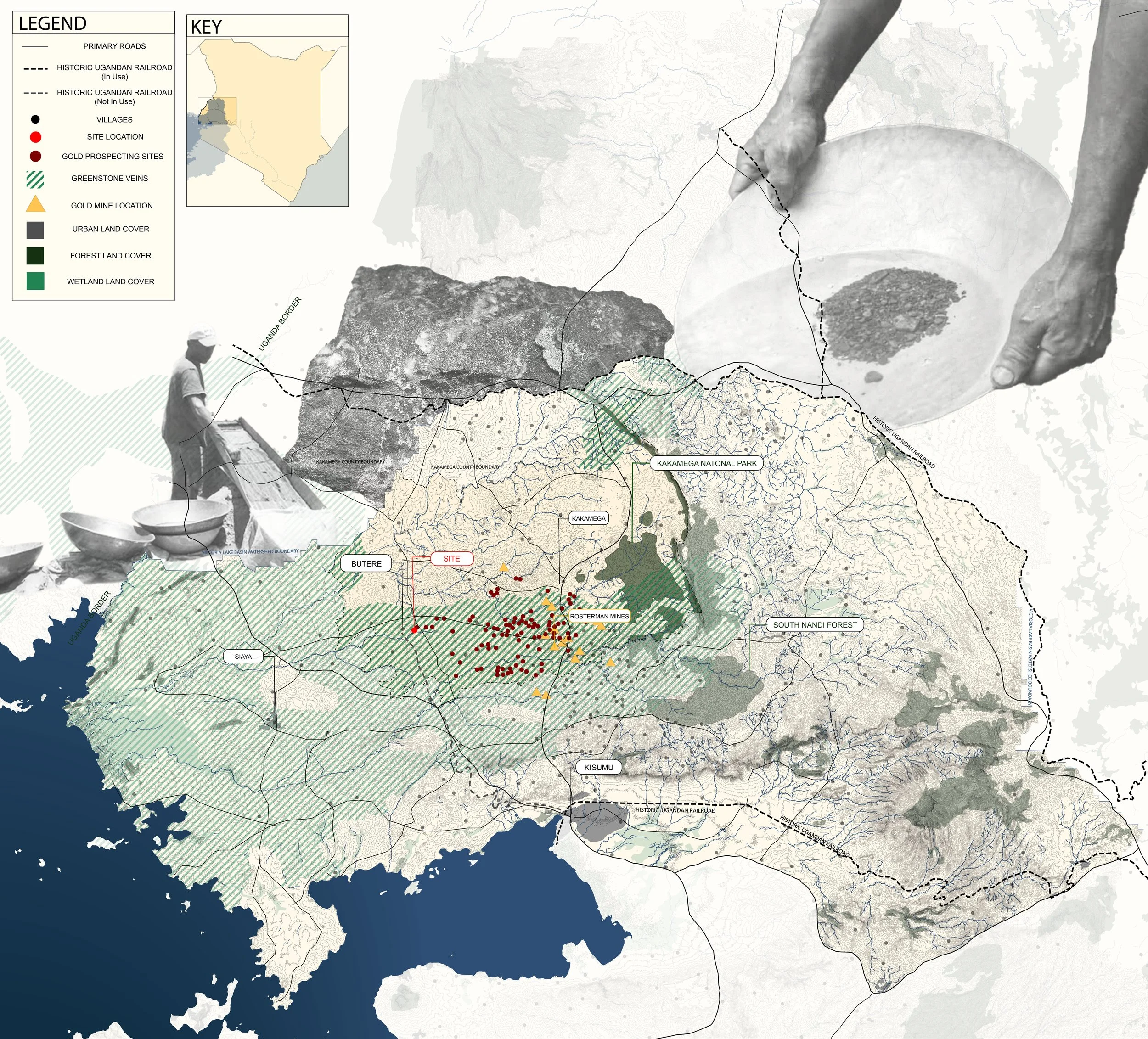
As a result, the gold-laden greenstone deposits that cover much of the western portion of the watershed have once again emerged as hopeful sources of income for local populations. The Kakamega region, named after the remnants of a rainforest that once spanned much of the landscape, is in the midst of another gold rush. These mines are rife with dangerous and extremely labor intensive practices: cave-ins are common and not all make it out alive.
Territory
Indigenous agricultural practices are returning in force, as locals are able to feed themselves more regularly with their own diverse plantings instead of relying on unreliable income from cash crop practices.
It is in this context that Dameron Architects designed its campus for the Kijana Global innovation school. Beginning with on-the ground needs and local labor and building techniques, The Kijana Global Innovation School’s library works with the landscape: improving climate, irrigation, and learning conditions for its students and staff.
Architecture and Agriculture
Dameron’s master plan of the Kijana global innovation school works in tandem with the landscape - leaving room for a diversity of subsistence farming throughout the campus that supports the students with quality meals throughout the year.
Architecture and Water
Facing more prolonged droughts and intense wet seasons, water collection and storage becomes an essential part of designing a sustainable building in the Kakamega region.
The Library’s roof acts as a large collection dish, slowly distributing up to two days of rainfall into collection tanks that then irrigate farming plots downhill of the building.